Did you know that National Records of Scotland (NRS) holds the largest known collection of original maps and plans of Scotland? Almost 2,500 of these records can be searched and downloaded for free on Scotland's People, and we are now pleased to announce that nearly 1,000 more images can now be explored. The maps and plans cover the whole of Scotland, dating from the mid-sixteenth century to the mid–twentieth century.
Amongst the newly added records are examples by notable Scottish surveyors and engineers, including Thomas Telford (1757-1834), Peter May (d. 1795) and John Home (1733/4-1809). Many of these plans feature areas of water, including lochs, rivers and harbours. 2020 is the Year of Coasts and Waters in Scotland and to celebrate, we have selected a few of these plans to examine in more detail.
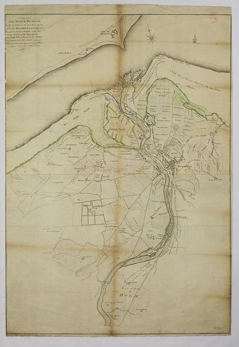
'A Plan of the River Ness with the banks and lands adjacent from the Holm Burn on the East and Clach-na-ha-gaig Stone on the west to the junction of the sea, with the low and high water mark from the Millburn to the March at the west side of the lands of Muirtown', 1774
Commissary Court records, Crown copyright, NRS, RHP672
This plan of the River Ness, Inverness-shire, is a detailed survey by John Home dated 1774. The River Ness’ origins at Loch Ness, some six miles away, are not depicted, but its discharge into the Beauly Firth is detailed in Home’s plan. The plan was utilised in a Commissary Court case of 1830 and lodged as a production in causa the Feuars of the River Ness against the Magistrates of Inverness (NRS, RHP35945). This plan was a useful resource, as the land owners along the river are noted by name, as well as depicting road connections between the Kessock ferry, Beauly and towards Nairn. You can learn more about the estate surveys conducted by John Home in our Open Book blog post.
A series of plans from the British Fisheries Society (BFS), are also included in this release. The BFS was established in 1786 and sought to increase economical productivity by creating a network of villages in the Highlands. This included the re-planning of existing fishing towns and villages and the creation of new communities. A previous conception of Ullapool by surveyor Peter May in 1757 (NRS, RHP3400) had been rejected. Instead, it was the prominent civil engineer Thomas Telford’s design that was realised. Telford was appointed to plan further villages and towns, including Pulteneytown near Wick, and Lochbay on Skye. Pulteneytown was named after the director of the society, Sir William Pulteney, who coincidentally, was also a patron of Thomas Telford.
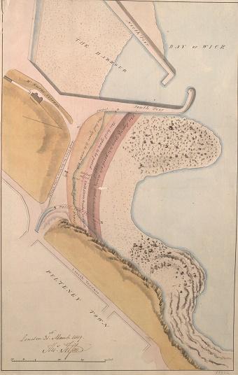
Telford's plan for Pulteneytown harbour. 1819
Records of the British Fisheries Society, Crown copyright, NRS, RHP11802
Telford’s Pulteneytown and Ullapool town designs were deemed a success. Lochbay, conversely, was the BFS’s great failure, and Telford’s plan was not developed. This may have been because Telford had employed fashionable architectural features such as squares and crescents which were seen as unnecessarily grandiose and impractical for a small fishing village.
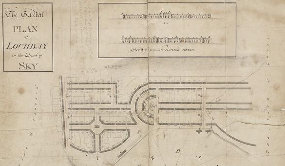
Detail of Telford's plan for Lochbay, Skye, 1791
Records of the British Fisheries Society, Crown copyright, NRS, RHP11791
Another highlight of the added images is George Brown’s proposed road linking the new settlement at Ullapool to Dingwall. The plan depicts the lochs and rivers along which the route follows. Brown was Peter May’s nephew, and plotted many routes throughout Scotland.
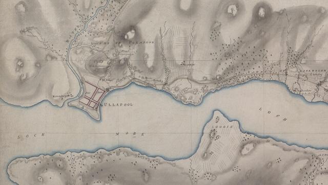
Detail of Brown's intended road between Dingwall and Ullapool, 1790
Ministry of Transport records, Crown copyright, NRS, RHP11593
The later maps of the BFS include a nationwide survey of Scottish fishing harbours, presented over 68 plans which are also now accessible on Scotland's People. (NRS, RHP93953/1-68, 1947-1957). Related material can be found in the Agriculture and Fisheries Department for Scotland series, (NRS, record series AF).
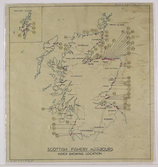
Plan created by the British Fisheries Society, noting locations of fishery harbours in Scotland [mid-twentieth century]
Records of the British Fisheries Society, Crown copyright, NRS, RHP93953/1
Find out more about searching these records by reading our maps and plans guide.