4,865 individual National Coal Board (NCB) statutory working plans have been released onto the ScotlandsPeople website. These plans can be searched on the maps and plans section of the website.
Created between 1955 and 1989, they cover much of the central belt of Scotland from Ayrshire through to Stirlingshire, working left to right across the country. In March 1987 the Coal Industry Act 1987 received royal assent, leading to the dissolution of the National Coal Board. Seven years later, in October 1994, The Coal Authority was established. The Coal Authority own, on behalf of the country, the vast majority of unworked coal in Great Britain, as well as former coal mines, and are the owners of these plans which are held at National Records of Scotland (NRS).
The plans were created following the passing of The Mines and Quarries Act 1954. It aimed ‘to make fresh provision with respect to the management and control of mines and quarries and for securing the safety, health and welfare of persons employed thereat; to regulate the employment of women and young persons; to require the fencing of abandoned and disused mines and of quarries; and for purposes connected to matters aforesaid.’ Areas with active or abandoned coal workings, including those underwater, were recorded.
The early 20th century witnessed a relative decline and stagnation in the coal mining industry, followed by a period of growth at the end of the Second World War. The coal industry was nationalised in 1947, and the NCB was the statutory corporation created to run the industry, taking 206 collieries in Scotland into state ownership and leaving at least another 105 small mines in to the private sector (Oglethorpe, Scottish Collieries, 2006, p.18). As Miles K Oglethorpe notes, “there was a genuine belief that working conditions and economic performance would be greatly improved. Signs reflecting the new confidence were erected in all nationalised pits, bearing the words, ‘This Colliery is now managed by The National Coal Board on behalf of the people.’” (Oglethorpe, p.1).
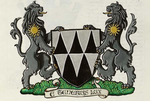
The National Coal Board’s coat of arms
Image reproduced with the kind permission of the Lyon Office
In 1967 the number of collieries operated in Scotland by the NCB stood at 65, and shrank by almost two-thirds in the ensuing decade. By 1987, the number had fallen further to only 11, and, by 1997, 50 years after 206 Scottish collieries had been taken over by the state, only two - Longannet and Monktonhall - were still operational. (Oglethorpe, Scottish Collieries, 2006, p.28)
In the mid-1950s, coal was the primary fuel for nearly all energy needs, only road transport and shipping relied more heavily on petroleum products (Oglethorpe, p.17). In a debate on 15th July 1954 in the House of Lords, The Earl of Selkirk commented that “the mining industry is unquestionably the most important industry in this country. A 10 per cent. increase in the production of coal would completely revolutionise the economic outlooks of the country.”
The process of coal production was powered by around 750,000 workers across various branches of the industry. One purpose of the act was to improve the safety of employees in what was a notoriously dangerous industry. The Earl of Selkirk noted in the debate that “when we deal with safety in the mines, safety in the air, or safety at sea…we are dealing with man’s struggle with nature, and that is really one of the major problems of this whole matter.”
This legislation required mine owners to keep accurate plans (on the site of the colliery) of all workings in a mine (whether abandoned or not), all other workings within the boundaries of a mine and accurate sections of the seams or veins and all the strata overlying them (section 17 of The Mines and Quarries Act 1954). The plans were reviewed and checked by inspectors and if any were found to be inaccurate, incomplete, dilapidated or wholly or partly decipherable, a surveyor could be instructed to create a new plan – the cost of which would be recoverable from the owner of the mine. (Section 19)
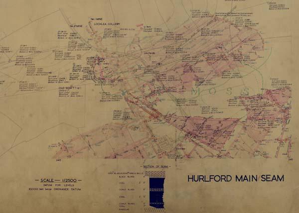
Detail from a plan illustrating the Hurlford main seam, 1953. NRS, RHP146000/99/2.
This copy is provided under the terms and conditions of ScotlandsPeople. This is not an official abandonment plan. Workings must be verified as to their completeness and accuracy in the official abandonment plans available from The Mining Heritage Centre, 200 Lichfield Lane, Mansfield (NG18 4RG) or The British Geological Survey, Research Avenue South, Edinburgh (EH14 4AP).
In the event of a mine being abandoned, or within 12 months from a mine last being worked, the owner of the mine was to send the district inspector plans of the workings in the mine. Plans were to be made from durable material and expected to show the position, in relation to objects on the surface, of the workings delineated on the plans and record such information as may be so specified with relation to orientation, contours, boundaries, faults, workings other than those delineated on the plans. (section 20) (Full details can be found in The Mines and Quarries Act 1954)
![Detail from a plan of Coal Board workings of Four Feet Seam (NT 36/4073), [20th century]. NRS, RHP146000/917/5. This copy is provided under the terms and conditions of ScotlandsPeople. This is not an official abandonment plan. Workings must be verified as to their completeness and accuracy in the official abandonment plans available from The Mining Heritage Centre, 200 Lichfield Lane, Mansfield (NG18 4RG) or The British Geological Survey, Research Avenue South, Edinburgh (EH14 4AP).](/sites/default/files/styles/maximum_size/public/2024-04/RHP---14600000917-00005-00001-%20Portobello%20600.jpg?itok=2nMb_NB2)
Detail from a plan of Coal Board workings of Four Feet Seam (NT 36/4073), [20th century]. NRS, RHP146000/917/5.
This copy is provided under the terms and conditions of ScotlandsPeople. This is not an official abandonment plan. Workings must be verified as to their completeness and accuracy in the official abandonment plans available from The Mining Heritage Centre, 200 Lichfield Lane, Mansfield (NG18 4RG) or The British Geological Survey, Research Avenue South, Edinburgh (EH14 4AP).
This legislation led to the creation of thousands of accurate plans of abandoned and active workings in the mine, as well as visual representations of seams or veins of coal. Today, these plans allow us to see the coal mining industry in a moment in time, as it developed and changed.
For more information and help on how to search this record set, please see our guide and glossary which explains some of the terms found in the plans.